Showing posts with label route. Show all posts

Thursday, March 1, 2012

#DeathMarch Planning Questions

Last Year Was A Blast-Story Here
For those that think they have a good route planned out for the Sub 9 Death March and are seemingly prepared, here are a few questions you should absolutely have an answer to before you clip in.

At the holeshot, are you turning left or right?

What about your teammate?

Are you sure that road marked on your map is an actual physical honest to goodness road?

Is that bridge physically crossable or a relic of an aged NASA Satellite photo?

What’s the elevation change between Camp and Hanner Cemetary?

How many valleys will you cross on your way to Lutes?

Are toe spikes a good idea or too much weight?

How are you going to wear toe spikes and shoe covers at the same time silly?

Have you every tried to read a map while riding a gravel road at 25 mph?


Shirley, you can't be serious?


Are you comfortable riding your bike under water?


Is there a compartment for a snorkel in your Hydrapak?

True or False:  Some of the gravel roads would be more stable under your wheels if they were paved 6 inches deep with marbles set in butter.

And, which roads are those?

Are you going up or down them?

If last year’s winning team from DRT spent 4 ½ Hours on their bikes and this year the promoters added a cemetery which is pretty dang far to the east which will no doubt extend saddle time, where and when do you plan on refilling your water?


What time does the sun set?

Is your cell phone’s camera memory close to being full?

Do you know what happens to a paper map in your jersey pocket 5 hours into a ride?

Do you know what happens to the same map after riding through countless creeks?

Are the Garmin and Google maps of Hoosier National Forest as up to date as their map of 
New York City, or are they as old as the farm roads that once criss-crossed the area?

Have you seen the Sprint cell phone coverage map of the area?

So, you're certain your phone's mapping app will be functional?


By the way, have you ever climbed a cell phone tower?

You may not be afraid of heights, but are you may afraid of climbing a Fire Tower which feels like it has the same pieces and stability of a 6 year old’s erector set project?

True or False: Trailheads in Hoosier National Forest are marked with a nice big well painted signs and arrows like the tourist trail to Mt. Rushmore?

If you let the weeds in your driveway grow for 60 years, could you still call it a driveway?


Have you planned your route to Callahan cemetery on the map?

So, when you looked at the Google map you saw Callahan’s tombstones and an adjacent trail together?

You really don’t know where Callahan is, do you?

Multiple Choice: In the pouring rain, what is faster in and out of Callahan?  A horse trail  B) A fresh gravel road  C) A Hard Packed Gravel Road  D) Pavement E) We should really have a Plan B.

Thursday, April 7, 2011

Going Out For Lunch in Cincinnati's Eden Park

Magnolias near Krohn Conservatory
I want to run

Snap photos in the park

Jump jack by the fountain

Revisit an old face


Daily Dare Devil
See something new

Clop up stone stairs

Breeze past the wall scaler

And hear a familiar wind whisper my ear

Carved Stone Pillar
Hesitate at the point

See a Magnolia in bloom


Snag the water bottle from my car


And drink it from the open tailgate


My Favorite Public Steps
So I abandon writing

Click close the windows

Open the double glass doors

And run in Eden Park

Monday, October 18, 2010

WIKI LEEKI: 2011 Tour De France Route Map Leaked

(Nose Hit News Service/Paris, France)  Just hours before Tour De France organizers planned release of de 2011 race route, Le Wiki Leeki (a French organization that is not on strike) allegedly unveiled portions of the route and uncorked the champagne themselves.  French authorities are redundantly calling it a faux hoax.  Included in the leak were details of new starting cities, a time trial in the Basque town of Testostero'ne, and a full map pictured below.

Stages 1 & 2
Stage 1, according to Le Wiki Leeki, takes place after the traditional prologue in Paris and follows the traditional flat start to the tour taking riders 135 miles from Clenbuterol, originally settled by Russian immigrants and finishes in Cera, known for its potent blood red wine.  Stage 2, the group contends, continues through the northern part of the country with an undulating 120 mile circumnavigation of the wine producing country between Vino and Landis'eille. 


Stages 6 & 7 
The first week of the tour ends with a bumpy ride, according to the Leeki, as the road tilts up for the first time.  Of particular interest is stage 7, which Wiki says will depart in Aach-Gee-Aach and finish 145 miles and three Category 2 climbs later in the Belgian town of Balco.


Stages 9-11 
These three stages take riders from through the heart of the Pyrenees Mountains in the middle of the 2nd week says Leeki.  While stage 9 from E'peeo to Cortisone features 3 HORS rated climbs, stage 10 ending in the ski resort town of Puerto is certain to be a pivotal stage Le Wiki reports,  since it will be followed by a stage 11 time trial from Homologous to Mayo, where mayonnaise was invented.


Full 2011 Tour Route Map

Monday, September 27, 2010

A KY Ride Nut For Winter: Kincaid-Claysville-Kincaid

Down here, they get the Sunday paper on Tuesday, one of my buddies joked.  “Claysville Kentucky hello.”  Personally, I pictured Larry King greeting the next caller from Tobacco  Basket, USA not realizing earlier the caller just finished hanging Tobacco to dry in the barn and now settled in for a little T-V.  I rode there yesterday.  Tobacco harvesting season is in full swing in Kentucky.  While some fields were still full of the giant yellowing leaves, others lie bare adjacent to a big black barn packed from floor to ceiling with hanging drying leaves.  While I’m not a fan of smoking, I am a fan of tobacco farming.  With the small black barns and plants with leaves as big as your face, it’s romantic in a way.  I don’t know if it’s true or not, but someone once told me the tobacco barns are black to draw more sunlit heat to the leaves.  While I didn’t smell any yesterday, in just the right conditions late in the summer you can smell the tobacco aroma from the fields and get a tish of a buzz.  Harry, my teammate and longtime Tobacco Basket resident, wrestled unwrapping a Clif Bar outside the Claysville General Store.  “It’s a dying breed,” he said in his soft drawl referring to the store’s genuine dusty boot-carved wooden floorboards which were perfectly unlevel.  Even having to hike around a warshed out bridge (pictured), it was a perfect end of summer ride.

“You know what’s wrong with this ride?”  All together now in staccato, "Not…A…Goddamned…Thing!”  I hate to say it, but the waning daylight doesn’t lie.  It was officially the last ride of the summer.  This blog post is my way of storing a ride nut away for winter.  I’m trying to remember the little details:  Grimes Road- pure Kentucky chip and seal no wider than a bridge of a dozen computer screens, tobacco hanging in little black barns so close to the side of the road you could practically reach inside and rip off a plug, the remarkably friendly farm dogs that just wanted to run with us for a while and drought baked dry creek beds revealing the flat stone underneath.  I like to think of the topography of Kentucky as God’s second draft.  Like he took a map of a flat tree lined beautiful forest, crumpled it up, uncrumpled it, and said, “There…that’s better.”  Then there was that kid on the Huffy.

My friend Tony, who scouted this route south of Kincaid Lake State Park near Falmouth, said the kid, now a young man, was involved in an ATV accident.  As they’d say in rural Kentucky, he’s a little slow.  In a voice that I’ll recall as heartbreaking, he slurred in a drawl, “y’all wanna race?”  My buddy replied, “Naw man, we’re just out for a ride.”  We turned past a house littered with aging old bikes in the front yard.  One of them, a rusted singlespeed with a Schwinn-like curving top tube and an orange panel decal caught our eye, but we didn’t stop and headed down another single lane road toward Claysville.

I don’t know how many hills we climbed, but everyone paid off with a panoramic vista of a creek carved valley.  The ride was a lumpy loop of what seemed like 90% single lane roads which sort of paralleled the Licking River Valley from Kincaid Lake State Park to Claysville touching Pendleton, Harrison and Bracken counties.  Tony brought up his recent trip to North Carolina and Virginia.  While the mountains are nice with their brutally long climbs, heavenly high views and hair raising descents, he reasoned that this was better.  Just off a recent trip to Park City, Utah I knew what he meant.  They payoffs are more frequent in Kentucky, and the price isn’t as high.  In the mountains you might climb up over one or two or three ridges in a long ride, here I literally lost count of the ridgelines, vistas and how many times I said wow.

Before we had left I mentioned the ride to a few friends on FB.  One replied asking, “how far and how fast?”  I had no idea.  Looking back, I seemingly clipped into the ride blind.  Maybe that made it even more enjoyable.  I didn’t care how fast or slow we rode, how much my legs hurt, how long it’d really take, how many miles, or how many climbs there’d be.  I really didn’t know where we were.  Sure I was somewhere around Falmouth, but I didn’t know where the next turn, or climb or sketchy chip and seal descent would be.  I really didn’t care.  I put my trust in two of my Kentucky buddies and like a movie, the ride just played out before my eyes.

Monday, September 28, 2009

Paradise Paved Over

That could be a photo of a country road you’d love to ride, a trickling creek to one side, rural homes dotting the other. (Photo: BioWheels-Mitch Graham) However, had you known Binning Road in its former state of dilapidated decrepit neglect, this photo might make you sad. It’s not often a road cyclist doesn’t celebrate new blacktop. Most recently, many of Northern Kentucky’s rural roads have been repaved, and they make you smile even more when you ride them. However, Binning Road, between Roundbottom and Hwy222, connecting Milford with Batavia northeast of Cincinnati was famous for its inner tube eating, death grip on the bars potholes and broken pavement. If the competitive group was in tact before Binning, especially the stretch between Roundbottom and the bridge, no doubt it’d be shredded on the way out. Binning taught teammates how to trust each other. Binning taught riders how to relax the death grip and really handle a road bike. Like a hometown Paris Roubaix sector of cobbles, Binning taught racers how to think ahead and get to the front. Binning also made local bike shops a tiny fortune in inner tube sales.

(Here’s what Binning was like before it got paved! Well…at least it felt that way.)

Like an ugly dog, for the past nine years, I learned to love Binning Road and its potholes, broken pavement, uneven surfaces, and the section where the road narrowed leaving only a double track or a dirt berm choice to ride around the rocks that had fallen from the adjacent railroad tracks. It was the worst road and the best road for all the same reasons. Cyclists chose Binning Road to avoid the busy Highway 50 when traveling from Round Bottom Road to Hwy 222 between Batavia and Milford. However, the real reason cyclists chose to ride Binning still exists: its fast-flat corners through its ever changing-with-the-seasons scenic valley farm fields. That vista might even be better now that you can unglue your eyes from the wheel in front of you. You might find yourself saying, “Wow, I had no idea what a pretty valley this is.”

At the root of it, Binning Road is dead to those that loved to push the pace while those with less nerve slid a finger down the brake lever and has new life to those who ever dropped a chain, flatted, or lost a something out of their seatbag. I’m going to miss the beat-up old Binning, but chances are I won’t be missing my tail light or my water bottle next time I come home from a ride.

Friday, October 3, 2008

Ghost Dog: a Joe Biker Blog Classic

As we continue to make "Out Of True" The Best Bike Blog Ever, and make the transition from the Joe Biker Blog on AOL which is closing it's Journals, here's an updated version of a classic from the archive dated Thursday, October 10th, 2006.

The Myth: It’s not a ride in Northern Kentucky till a dog chases you

The Truth: It’s not a ride in Northern Kentucky till a dog chases you.

I’m sure no matter where you live you can substitute a different area where you live for Northern Kentucky, even if you live in LA or wherever. In that case, the slogan may go like this: it’s not a ride in Beverly Hills till the paparazzi chase you. Same difference. I’m sure they’re just as vicious.

There’s one dog in Northern Kentucky that is particularly stealthy and wicked fast. We call him Ghost Dog. We know the general area where he lives. The problem is where Ghost Dog lives and what he calls his territory are two entirely different things.

For those of you who live around Cincinnati, Ghost Dog’s territory is along Route 8 (the road that runs along the Ohio River) somewhere between Mentor and Silver Grove, KY. There’s only one dog that chases in that stretch…and that my friend is Ghost Dog.

I have no idea what breed or mix Ghost Dog is. I’m guessing’ he’s a mix of Usain Bolt, the Stealth Bomber and German Sheppard. He’s black with some gray mixed in, has a boxy build, doesn’t show up on radar and I’m sure has a few Olympic Gold medals hanging in his doghouse.

Not only does Ghost Dog have a kick like Lotto’s Robbie McEwen, he also knows how to hide and break out his sprint at just the right moment just like Lotto’s Robbie McEwen.

The stretch of road where Ghost Dog lives is protected by a steep little hill lined with tall scraggly bushes. So, Ghost Dog has the element of surprise on his side. Also, the fact that the other side of the road has no shoulder and a steep deep ditch along the Ohio River leaves the wayward cyclist no escape.

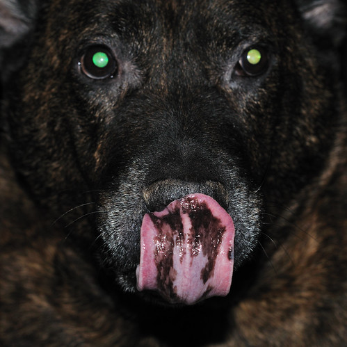
This is how ghost dog appears to a cyclist. You’re tooling along Route 8 at maybe 21mph. The sky is blue. The hills are a lush green. The river is peaceful. You’re likely watching a barge push it’s way up river. (Insert innocent happy whistle here) ALL OF A SUDDEN! There’s a beastly black dog 10 feet from you traveling at 35mph. Within .008 seconds he’s nipping’ at your Sidi’s and putting steak sauce on your sculptured calves. Your heart rates jacks to 102% asyou realize you are now the star of Scary Movie 5. He bounds in front, behind, to the left, to right…now dip baby dip. The hip-hop dance of death. And, you soon find yourself off your bike fending him off by trying to put your bike between your clean shaved legs and his drooling jowls.

Ghost Dog doesn’t want to eat you. He just wants to taste the fear in your sweat.

However, there are positive sides to Ghost Dog.

Number One: you get an accurate reading of your maximum heart rate.

Number Two: if you ever get strong enough to out-sprint Ghost Dog…it’s an automatic upgrade to a Category 2 USCF road-racing license.